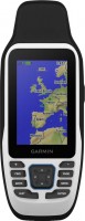
Magellan Triton 200
 | Outdated Product Portable GPS navigator for use with hiking trips. From one set of 2 AA batteries, this device can work up to 10 hours continuously. True, if you use a screen backlight or a magnetic compass, this time can be significantly reduced. The navigator is able to store up to 20 routes and up to 25 waypoints on them. The cold start time of the receiver does not exceed 2 minutes, warm - 20 seconds. |
Close
We recommend products in stockSat Navs Magellan →

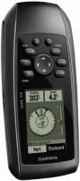
handheld, 2.2 ", water protection IPX7, non chargeable batteries, up to 25 hours of work, 142 g
handheld, 2.6 ", water protection IPX7, non chargeable batteries, up to 18 hours of work, 203 g

handheld, 2.2 ", memory 8 GB, water protection IPX7, non chargeable batteries, up to 25 hours of work, 142 g


handheld, 2.2 ", water protection IPX7, non chargeable batteries, up to 168 hours of work, 157 g

handheld, 2.2 ", memory 3.7 GB, water protection IPX7, non chargeable batteries, up to 25 hours of work, 142 g
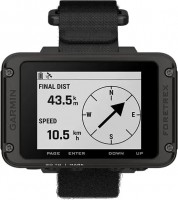
wrist-mounted, 2.2 ", ANT+, water protection IPX7, non chargeable batteries, up to 100 hours of work, 108 g

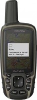
handheld, 2.2 ", memory 8 GB, ANT+, water protection IPX7, non chargeable batteries, up to 25 hours of work, 142 g
handheld, 2.6 ", memory 8 GB, ANT+, non chargeable batteries, up to 16 hours of work, 230 g
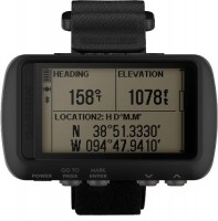
wrist-mounted, 2 ", water protection IPX7, non chargeable batteries, up to 48 hours of work, 88 g
handheld, 3 ", memory 8 GB, water protection IPX7, non chargeable batteries, up to 19 hours of work, 282 g

handheld, 2.6 ", memory 16 GB, ANT+, water protection IPX7, non chargeable batteries, up to 16 hours of work, 217 g

wrist-mounted, 2 ", water protection IPX7, non chargeable batteries, up to 48 hours of work, 88 g

handheld, 2.6 ", memory 16 GB, ANT+, water protection IPX7, non chargeable batteries, up to 16 hours of work, 217 g

handheld, 2.6 ", memory 4 GB, water protection IPX7, non chargeable batteries, up to 16 hours of work, 159 g
Magellan Triton 200
Type:handheld
Screen size:2.2 "
Resolution:320х240 px
Working hours:up to 10 h
Weight:187 g
Portable GPS navigator for use with hiking trips. From one set of 2 AA batteries, this device can work up to 10 hours continuously. True, if you use a screen backlight or a magnetic compass, this time can be significantly reduced. The navigator is able to store up to 20 routes and up to 25 waypoints on them. The cold start time of the receiver does not exceed 2 minutes, warm - 20 seconds.
All specifications
Specifications Triton 200
|
| |||||||||||||||||||||||||||||||||||||||||||||||||
The information in the model description is for reference purposes.
Always clarify the specifications and configuration of the product with the online store manager before purchasing.
Catalog Magellan 2026 - new arrivals, bestsellers, and the most relevant models Magellan.
Always clarify the specifications and configuration of the product with the online store manager before purchasing.
Catalog Magellan 2026 - new arrivals, bestsellers, and the most relevant models Magellan.
Additional features sat nav Magellan Triton 200:
WAAS (Wide Area Augmentation System) is a system designed to increase the accuracy of satellite navigation instruments. The principle of operation of the system is based on the correction of satellite data with the help of special corrections, which are calculated by base stations installed in the service area of the system.
- WAAS technology
- Accuracy: less than 7 metres, when using WAAS — less than 3 metres
- Update rate — 1 time / sec
- Magnetic compass
- Operating temperature -10° to + 60°C
WAAS (Wide Area Augmentation System) is a system designed to increase the accuracy of satellite navigation instruments. The principle of operation of the system is based on the correction of satellite data with the help of special corrections, which are calculated by base stations installed in the service area of the system.