Magellan eXplorist 500
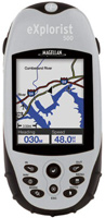 | Outdated Product $340.00 Application area: handheld; Water protection; Number of routes: 20; Waypoints: 500; Navigation features: Bands number: 14; screen size ("): 2.25; resolution (px): 120х160; USB; memory card slot; Battery life (h): 14; Dimensions (mm): 117х53х33; |
Close
We recommend products in stockSat Navs Magellan →
handheld, 3 ", memory 8 GB, water protection IPX7, non chargeable batteries, up to 19 hours of work, 282 g

handheld, 2.2 ", memory 8 GB, ANT+, water protection IPX7, non chargeable batteries, up to 25 hours of work, 142 g

wrist-mounted, 2.2 ", ANT+, water protection IPX7, non chargeable batteries, up to 100 hours of work, 108 g

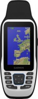
handheld, 2.6 ", memory 16 GB, ANT+, water protection IPX7, non chargeable batteries, up to 16 hours of work, 217 g


handheld, 2.2 ", memory 8 GB, water protection IPX7, non chargeable batteries, up to 25 hours of work, 142 g

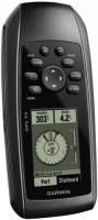
handheld, 2.2 ", water protection IPX7, non chargeable batteries, up to 25 hours of work, 142 g
handheld, 2.6 ", water protection IPX7, non chargeable batteries, up to 18 hours of work, 203 g

handheld, 2.2 ", water protection IPX7, non chargeable batteries, up to 168 hours of work, 157 g

handheld, 2.6 ", memory 16 GB, ANT+, water protection IPX7, non chargeable batteries, up to 16 hours of work, 217 g

handheld, 3 ", memory 16 GB, Wi-Fi, ANT+, water protection IPX7, up to 180 hours of work, 230 g

handheld, 3 ", memory 4 GB, Wi-Fi, ANT+, water protection IPX7, up to 18 hours of work, 272 g

handheld, 3 ", memory 16 GB, Wi-Fi, ANT+, water protection IPX7, up to 180 hours of work, 230 g
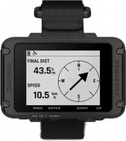
wrist-mounted, 2.2 ", ANT+, water protection IPX7, non chargeable batteries, up to 100 hours of work, 108 g
Magellan eXplorist 500
Type:handheld
Screen size:2.25 "
Resolution:120х160 px
Working hours:up to 14 h
All specifications
Specifications eXplorist 500
|
| |||||||||||||||||||||||||||||||||||||||||||||||||||||||||||
The information in the model description is for reference purposes.
Always clarify the specifications and configuration of the product with the online store manager before purchasing.
Catalog Magellan 2025 - new arrivals, bestsellers, and the most relevant models Magellan.
Always clarify the specifications and configuration of the product with the online store manager before purchasing.
Catalog Magellan 2025 - new arrivals, bestsellers, and the most relevant models Magellan.
Additional features sat nav Magellan eXplorist 500:
Magellan eXplorist 500 is built using TrueFix technology, which allows you to receive satellite GPS signals. The device is equipped with 16 MB of built-in non-volatile memory, 8 MB of which are used by the detailed base map, and another 8 MB are intended for storing 500 user points, 5 trajectories and 20 routes. At the same time, you can save an unlimited amount of user data (waypoints, routes, trajectories) on the memory expansion card (SD-card).
Good to know:
WAAS technology
WAAS (Wide Area Augmentation System) is a system designed to increase the accuracy of satellite navigation instruments. The principle of operation of the system is based on the correction of satellite data with the help of special corrections, which are calculated by base stations installed in the service area of the system.
- WAAS technology
- Magellan eXplorist 500 GPS Navigator
- Charger from the mains 220 V
- Li-ion battery
- Charger from the cigarette lighter
- USB cable
- Car mount
- User guide
Magellan eXplorist 500 is built using TrueFix technology, which allows you to receive satellite GPS signals. The device is equipped with 16 MB of built-in non-volatile memory, 8 MB of which are used by the detailed base map, and another 8 MB are intended for storing 500 user points, 5 trajectories and 20 routes. At the same time, you can save an unlimited amount of user data (waypoints, routes, trajectories) on the memory expansion card (SD-card).
Good to know:
WAAS technology
WAAS (Wide Area Augmentation System) is a system designed to increase the accuracy of satellite navigation instruments. The principle of operation of the system is based on the correction of satellite data with the help of special corrections, which are calculated by base stations installed in the service area of the system.