Garmin GPS 72
 | Outdated Product £481.42 The control keys of this portable GPS navigator are located in the upper part of the body, so the gadget is easy to operate with one hand. The waterproof case of the device (protection level IPX7) allows you to use it in the most severe weather conditions. The navigator supports loading maps and is able to remember up to 50 routes. The screen of the navigator is monochrome, with a diagonal size of 2.7". The operating time from a set of batteries is up to 16 hours. |
Close
We recommend products in stockSat Navs Garmin →

handheld, 3 ", memory 4 GB, Wi-Fi, ANT+, water protection IPX7, up to 18 hours of work, 272 g

handheld, 3 ", memory 16 GB, Wi-Fi, ANT+, water protection IPX7, up to 180 hours of work, 230 g
handheld, 3 ", memory 16 GB, Wi-Fi, ANT+, water protection IPX7, up to 35 hours of work, 230 g

handheld, 2.6 ", memory 16 GB, ANT+, water protection IPX7, non chargeable batteries, up to 16 hours of work, 217 g
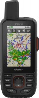
Garmin GPS 72
Type:handheld
Screen size:2.7 "
Resolution:120х160 px
Power supply:non chargeable battery
Working hours:up to 16 h
Weight:218 g
The control keys of this portable GPS navigator are located in the upper part of the body, so the gadget is easy to operate with one hand. The waterproof case of the device (protection level IPX7) allows you to use it in the most severe weather conditions. The navigator supports loading maps and is able to remember up to 50 routes. The screen of the navigator is monochrome, with a diagonal size of 2.7". The operating time from a set of batteries is up to 16 hours.
All specifications
Specifications GPS 72
|
| |||||||||||||||||||||||||||||||||||||||||||||||||||||
The information in the model description is for reference purposes.
Always clarify the specifications and configuration of the product with the online store manager before purchasing.
Catalog Garmin 2025 - new arrivals, bestsellers, and the most relevant models Garmin.
Always clarify the specifications and configuration of the product with the online store manager before purchasing.
Catalog Garmin 2025 - new arrivals, bestsellers, and the most relevant models Garmin.
Additional features sat nav Garmin GPS 72:
Good to know:
WAAS technology
WAAS (Wide Area Augmentation System) is a system designed to increase the accuracy of satellite navigation instruments. The principle of operation of the system is based on the correction of satellite data using special corrections, which are calculated by base stations installed in the service area of the system.
- WAAS technology
- Ability to connect to a computer via COM port
- Hunter/fisher calendar
- Sunrise/sunset and moon phase information
- Tide table
- Area calculation
- Garmin GPS 72H — equipped with a state-of-the-art high sensitivity receiver that acquires and acquires satellite signals quickly and maintains high accuracy
Good to know:
WAAS technology
WAAS (Wide Area Augmentation System) is a system designed to increase the accuracy of satellite navigation instruments. The principle of operation of the system is based on the correction of satellite data using special corrections, which are calculated by base stations installed in the service area of the system.