Map coverage
The region of the world for which map data is available on your navigation device. Map coverage determines which geographic areas and countries can be displayed and used for navigation on a specific device. Note that coverage may vary in detail and content: some preset maps may contain detailed information about roads, landmarks, shops, gas stations and the like on a global scale, while others are often limited to the basic road network for a particular country or region .
To make it easier to find a suitable solution for map coverage, registrars can be divided into several subcategories based on territoriality:
Europe,
Africa,
the whole world.
Lifetime map updates
Availability
of life-long updating of maps in this model of the navigator.
When buying a navigator with this feature, the user also acquires a subscription to map updates supplied in the kit. Such a subscription, in fact, is perpetual: updates are available all the time while the navigator is generally working. Thus, this service allows you to always have the latest maps at your disposal. It is found mainly in automotive and motorcycle models: it is for these areas of application that regular updates are most relevant, since traffic conditions can change very quickly. However note that the cost of subscribing to updates is included in the price of the device and affects it, sometimes quite noticeably.
TMC receiver
The presence
of a TMC receiver in the design of the navigator.
TMC (Traffic Message Channel) is a technology for transmitting information about adverse traffic situations — traffic jams, accidents, weather conditions, etc. Transmissions are most often carried out in the FM band, similar to conventional radio broadcasting; therefore, you do not need to access the Internet to obtain important traffic information, although some TMC services may be chargeable.
It is worth bearing in mind that a network of appropriate stations is required to use TMC. Such networks exist in many European countries, but their development in the post-Soviet space began relatively recently. Therefore, before buying a navigator with this function, you need to check whether TMC coverage is available in your area.
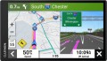
Display
Parameters of the display installed in the navigator.
— Display diagonal. Size screen size in inches. The larger the screen, the more information can be displayed on it and the more detailed this information will be presented. On the other hand, the size of the display significantly affects the dimensions of the device, and large screens are more expensive.
— Display resolution. Display size in dots (pixels) horizontally and vertically. The higher the resolution (with the same diagonal), the more detailed and clear the image the screen can produce. In addition, on high-resolution displays, small details are better visible, which increases the comfort of viewing information. Too high a resolution is usually not required for GPS navigator displays: for example, 800x480 pixels, limited by the standards of smartphones or tablets, with a diagonal screen size of about 6” are considered quite sufficient even for an advanced device.
— Matrix type. This parameter is indicated mainly for tech cases when the screen uses a high-quality
IPS type matrix. This technology provides high quality color rendering, good brightness and wide viewing angles; moreover, IPS screens are relatively inexpensive to produce.
- Touch. Screen support for touch control. You can give commands to the device by touching the icons on the display itself - similar to how this is done in smartphones and tablets. Touch control opens up
...many more possibilities than classic controls and provides flexibility in working with the navigator. In particular, by touching the screen you can set points on the route, zoom in or out on the map, etc.
- Color. This parameter determines whether the screen is color or monochrome (black and white). Black and white displays are simple, inexpensive, consume little power, and are quite suitable for displaying basic navigation information. At the same time, color screens are more functional: maps often use different colors to highlight individual objects, which would not be possible on monochrome displays. As a result, black and white screens are quite rare among modern navigators - mainly among the most compact and inexpensive models.
— Backlight. The screen has its own backlight system. This function makes the device independent of external lighting: the illuminated image will be normally visible both at dusk and even in complete darkness. It is also worth noting that many LCD screens have a backlight by default; it is activated when the screen itself is turned on and works regardless of external lighting - without it, the image on the matrix would simply be impossible to see. In particular, this operating principle is used in IPS-type matrices, which have gained popularity in modern portable electronics (including navigators).